Foundational Asset Condition Assessment Project progress update - June

10 June 2025
Moving into Week 18 of Murray Irrigation's Foundational Asset Condition Assessment Project (FACAP) Field Survey, the company is pleased to report the following progress:
The Aerial Photogrammetry Survey is now approximately 98% completed, with some small areas of infill to be finalised.
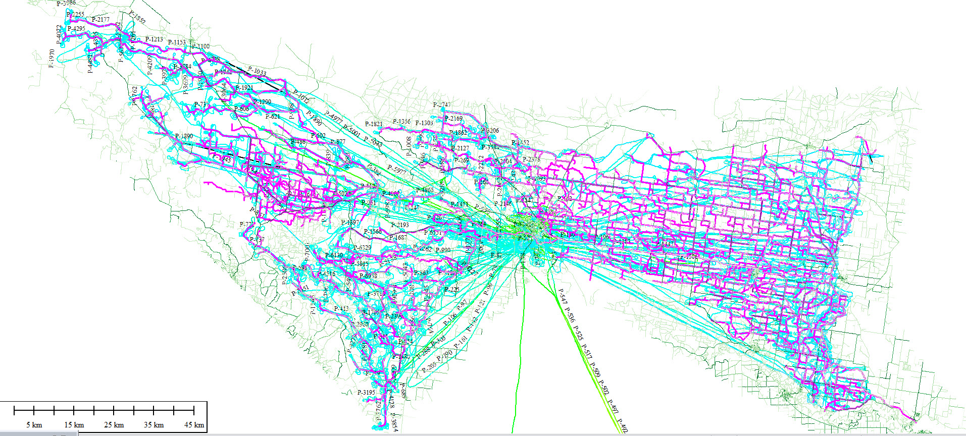
The below image depicts the Aerial Survey progress east and west of the footprint. The blue lines depict the flightpaths, while magenta represents the Murray Irrigation network.
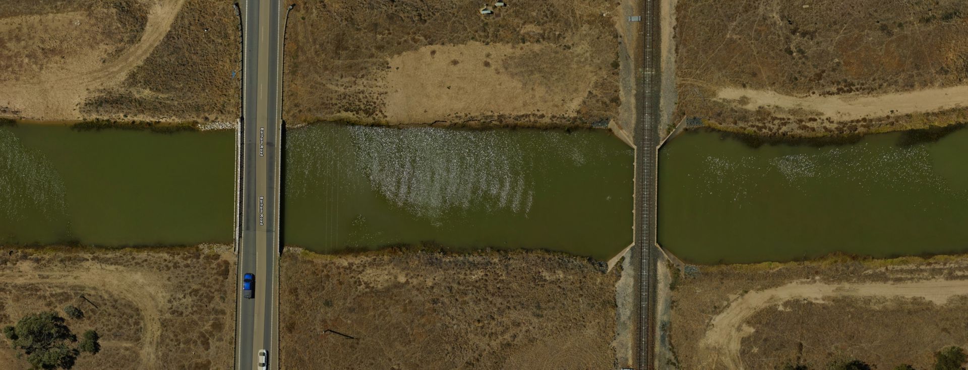
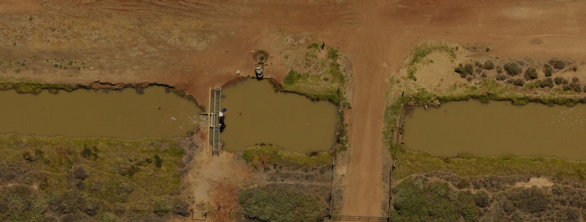
The below images demonstrate the imagery that is being produced by the Aerial Photogrammetry Survey.
The Bathymetric Survey is now approximately 85% complete, with survey crews completing approximately 18-20km per crew each day.
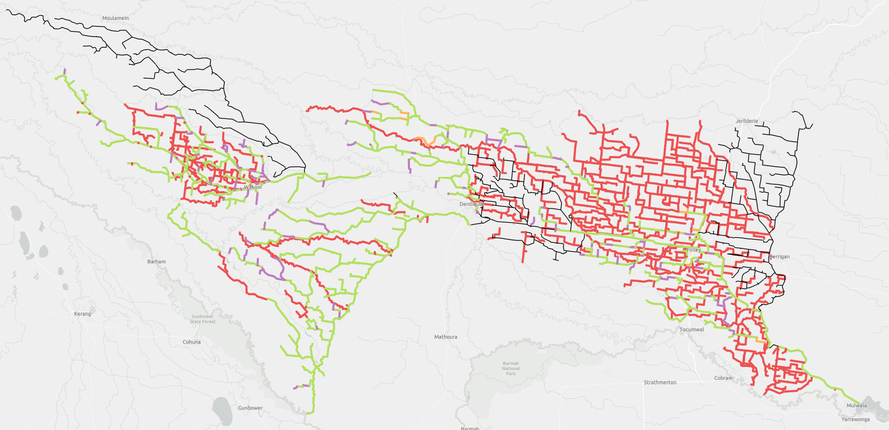
The green lines in the image below depict the area captured to date, while red represents the area yet to be completed and grey represents Murray Irrigation's Winter Works maintenance zone.
In this regard, the project team has taken advantage of the Winter Works period to introduce LiDAR (Light Detection and Ranging) aerial technology to specifically survey more than 1000 kilometres of channel which has been dewatered for Winter maintenance activity.
This methodology uses a fixed wing aircraft travelling at 1000ft (similar to Photogrammetry) to generate high-quality channel profile information which would not normally be able to be captured, as LiDAR technology does not penetrate water.
